| Ocean: | Marginal basin, southern West Philippine Sea |
| Spreading center type: | Not known - possible back-arc basin spreading center |
| Time of cessation: | Not constrained by available data |
| Subsequent active spreading center: | Not known |
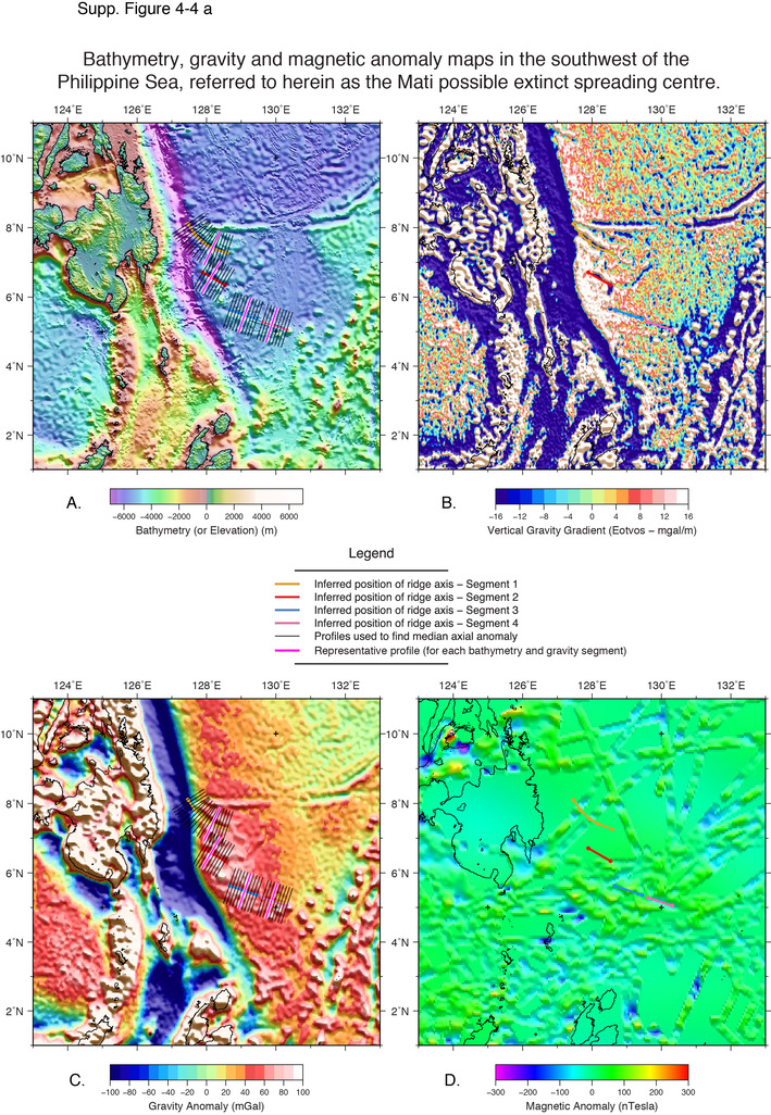
The southwest corner of the Philippine Sea is poorly studied and few studies have proposed age constraints for the crust in this region. Review of updated satellite gravity (Sandwell et al., 2014) shows an apparently segmented, right-stepping structure that stretches around 500 km from the east coast of the Philippines, almost directly west of Palau. The structure is found to the south of an east-west oriented fracture zone, or pseudofault, that appears to differentiate crust from a different episode of spreading. It is proposed here that the general structure of this feature in map-view is similar to an inactive spreading center. The gravity signal shows linear lows along the inferred axial segments and inferred transform faults that are found perpendicular to the segments that have positive anomalies on their western extents, which may represent uplifted flanks.
As far as we are aware, no previous studies have reported a spreading center within the southern portion of the Philippine Sea. Existing tectonic models of the region have not discussed the change in structural trend that is evident below 8° N from recent gravity data (Sdrolias et al., 2004; Hilde and Lee, 1984). This study predicts that the crust in this region has its conjugate in the north of the Philippine Basin, yet this interpretation is not compatible with the significant north-south asymmetry observed within the basin across the former West Philippine Basin spreading center and the variable tectonic fabric.
Insufficient information is available to verify that this is an extinct spreading cenete or the timing and tectonic setting of this possible extinct spreading center, therefore we cannot speculate as to the possible reasons for cessation.
The ‘Mati’ ridge, in the western Palau Basin, of the southern West Philippine Sea, bears the closest resemblance to an extinct ridge in map view, profile and by the magnitude of the gravity anomalies at axial segments, which are consistent with those of well-defined ridges. However, with limited magnetic anomaly identifications in the western Palau Basin, or other age constraints on the crust in the region of the proposed extinct ridge, further data are needed to evaluate this structure.
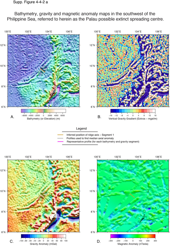
The ‘Palau’ feature, to the east of the Palau Basin, is less characteristic of an extinct ridge in map view, although it bears some resemblance to the most easterly segment of the West Somali Basin extinct ridge. The inferred axial location is a bathymetric trough, however the morphology is complex and highly variable, making it difficult to conclude that the segment is an extinct ridge segment. The ‘Palau Ridge’ is an intriguing structure for its similarity to the eastern West Somali Basin extinct ridge segment and therefore would be an interesting target for further investigation.
MacLeod, S. J., Williams, S. E., Müller, R. D., Matthews, K. J. and Qin, Xiadong (submitted manuscript), A global review and digital database of extinct spreading centres, Submitted to Geosphere, 17 June, 2016.
Sandwell, D., Müller, R. D., Smith, W. H. F., Garcia, E. S. and Francis, R., 2014, New global marine gravity model from CryoSat-2 and Jason-1 reveals buried tectonic structure, Science, v. 346, no. 6205, p. 65-67.


