| Ocean: | Pacific |
| Spreading centre type: | Large-scale MOR |
| Time of cessation: | 27 Ma, Chron C9 (Cande et al., 2000) |
| Subsequent active spreading centre: | A new segment of the SEIR became active directly to the north |
| Cessation style: | No reduction in spreading rate evident |
| Later deformation or volcanism: | Later Pliocene reactivation noted by Müller et al. 2005. Granot et al. 2010 further report than three phases of post-spreading deformation took place. |
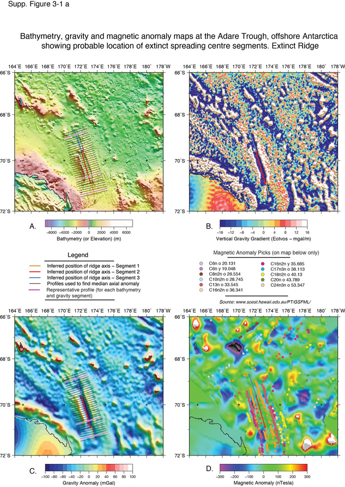
The Adare Trough is situated in the far south west of the Pacific Ocean, offshore the Antarctic margin and immediately southeast of Balleny Island. Cande et al. 2000 reported the presence of the extinct spreading centre after review of satellite gravity data, swath bathymetry, magnetic data and seismic reflection data. They found that spreading had been asymmetric, with 5.5 mm/yr on west flank and 7 mm/yr on east flank and tectonic deformation was concentrated on the western flank (Cande et al. 2000). With the regional context, the spreading centre expressed relative motion between East and West Antarctica, which had lead to increased magmatic activities in Marie Byrd Land and the Ross Sea.
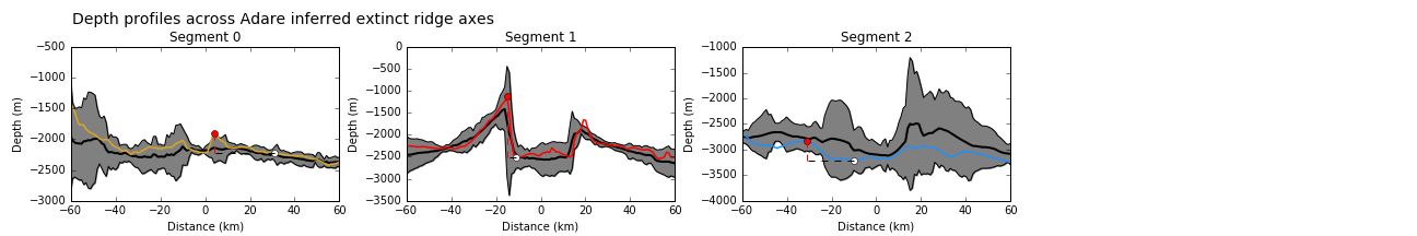
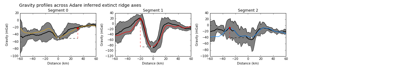
Müller et al. 2005 later investigated the chronology and nature of extensional faults that are found in the Adare Trough, from ship-track gravity data and interpreted seismic lines, in order to assess the temporal relationship between sea-floor spreading in this region and further deformation. They used gravity inversion to infer crustal thickness about the trough using the mantle Bouguer anomaly and report thickened and asymmetric crust across the rift axis, with a range of crustal thickness from 9 to 10.5 km. Spreading rates were believed to have been consistent both "temporally and spatially" so can't explain the variation in crustal thickness (Müller et al. 2005).
It is argued that the cessation of subduction along the East Gondwana boundary may have influenced the regional mantle temperature and flow regimes to local ridges (Granot et al. 2010), which could explain an observed excess volcanism and thickened crust (Whittaker and Muller, 2006).
Cessation of spreading within the Adare Basin is believed to have resulted from larger-scale plate boundary reorganisations, including a gradual reduction in the motion between East and West Antarctica and cessation of spreading to the south and east of Tasmania in the Emerald Basin (Cande et al. 2000).