EMAG2: Earth Magnetic Anomaly Grid
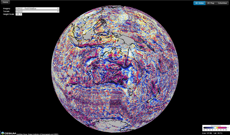
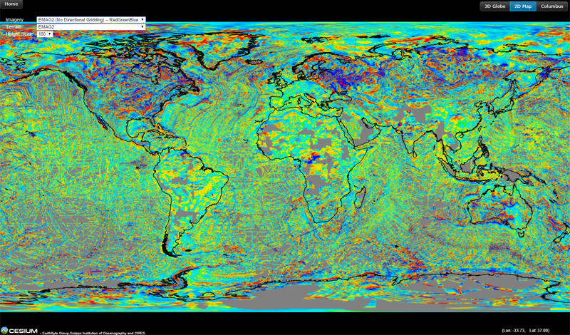
Magnetic anomaly maps allow us to look into the subsurface structure and composition of the Earth's crust. The magnetic variations in successive bands of ocean floor parallel to the mid-ocean ridges provide evidence of the temporal evolution of oceanic crust. The magnetic anomaly is important to the theory of seafloor spreading and plate tectonics.
The grid of magnetic anomalies is from EMAG2 (Maus et al., 2009). Two colour schemes have been used to render the grid -- RedWhiteBlue and RedGreenBlue. Two versions of the grid have been used in the 3D virtual globe. One uses the directional gridding to fill the gaps. And the other does not use the directional gridding to fill the gaps. Users can switch the imagery layer by clicking the combobox at the top left corner of the 3D globe page. More information, as well as the original data sets in their full resolution, can be found at http://www.geomag.org/models/emag2.html.
Explore EMAG2 Grid on 3D Virtual Globe
Reference:
Maus, S., et al. (2009), EMAG2: A 2-arc min resolution Earth Magnetic Anomaly Grid compiled from satellite, airborne, and marine magnetic measurements, Geochem. Geophys. Geosyst.,10, Q08005, doi:10.1029/2009GC002471.