Professor of Geophysics
Dietmar Müller
The University of Sydney
Web Architect & Developer
Xiaodong Qin
The University of Sydney

Future Fellow
Simon Williams
University of Tasmania

Future Fellow
Adriana Dutkiewicz
The University of Sydney

Senior Research Engineer
Simon O'Callaghan
Data61
Professor of Geophysics
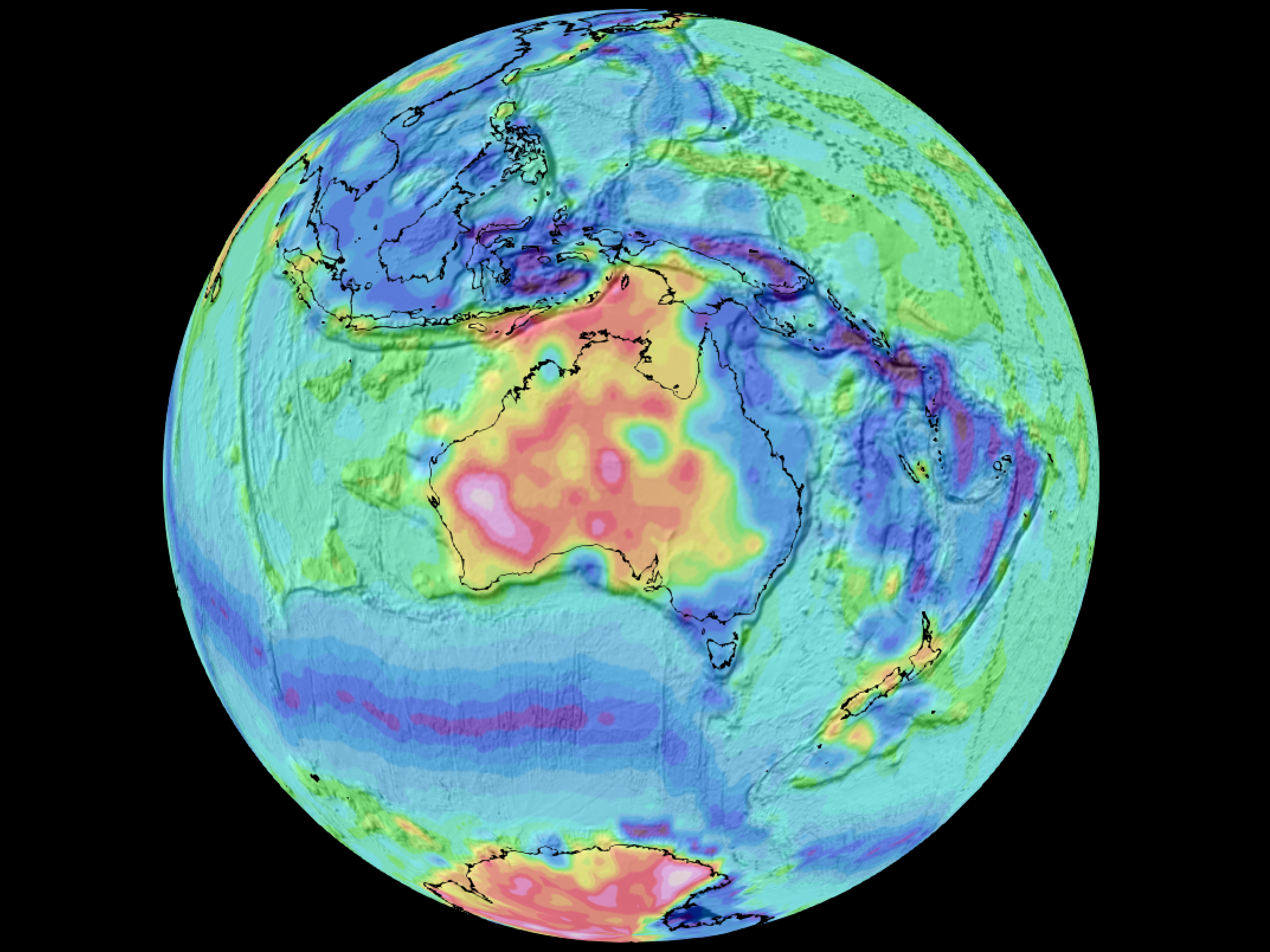
David Sandwell
Scripps Institution of Oceanography
Senior Scientist, Geomagnetism
Stefan Maus
(CIRES) University of Colorado

Professor and ARC Laureate Fellow
Zheng-Xiang Li
Curtin University
Associate Professor
Nicolas Flament
University of Wollongong
John E. and Hazel S. Smits Professor of Geophysics
Michael Gurnis
California Institute of Technology

Associate Professor
Maria Seton
The University of Sydney
Associate Professor
Joanne Whittaker
IMAS, Univ. of Tasmania
Senior Scientist and Head of the Geodynamic Modelling Section
Sascha Brune
GFZ German Research Centre for Geosciences
Senior Research Informatics Officer
Nathaniel Butterworth
Sydney Informatics Hub
Sarah MacLeod
Flood Forecaster
Mandi Thran
Bureau of Meteorology
Adjunct Professor
Christopher Scotese
Emeritus, University of Texas
A/Prof.
Juan Carlos Afonso
ITC, University of Twente